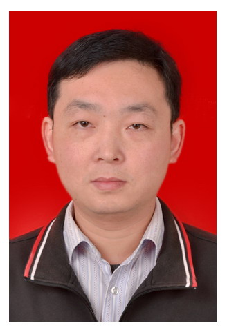
凌峰,男,1979年4月出生,安徽安庆宿松人。理学博士,研究员。1999年于中国地质大学(武汉)获学士学位,2002年于中国地质大学(武汉)获硕士学位,2006年于华中科技大学获博士学位,2015年10月至2016年10月University of Nottingham访问学者。现为Remote Sensing Letters,Remote Sensing in Ecology and Conservation期刊Associate Editor,Remote Sensing期刊Editor Board Member。主要从事遥感信息提取及遥感技术在资源环境领域的应用研究工作,提出了多源遥感影像时空超分辨率制图模型,在遥感影像尺度转换、多源遥感信息融合及全球变化关键因子遥感监测等方面取得了一定成果。已主持中国科学院/湖北省人才项目、湖北省创新群体等多项科研项目。以第一/通讯作者在Remote Sensing of Environment、Water Resource Researches等学术期刊上发表SCI论文100余篇,引用5000余次,获2016年ASPRS Boeing Award for Best Scientific Paper in Image Analysis and Interpretation,2020年The Taylor & Francis Remote Sensing Letters Award,2024年Wiley威立中国高贡献作者奖。
电子邮件: lingf@whigg.ac.cn
通信地址: 湖北省武汉市徐东大街340号中科院测地所
邮政编码: 430077
教育背景
1999-09--2002-06 中国地质大学(武汉) 硕士
1995-09--1999-06 中国地质大学(武汉) 本科
1992-09--1995-06 安徽省桐城中学 -
工作经历
工作简历
2015-10~2016-10,University of Nottingham, 访问学者
2010-11~2016-12,中国科学院测量与地球物理研究所, 副研究员
2006-12~2010-10,中国科学院测量与地球物理研究所, 助理研究员
社会兼职
2020-01-01-今,Remote Sensing, Editor Board Member
2019-12-01-今,Remote Sensing Letters, Associate Editor
专利与奖励
(2)2020年,英国摄影测量与遥感学会,The Taylor & Francis Remote Sensing Letters最佳论文奖
(3)2016年,美国摄影测量与遥感学会,Boeing最佳论文奖
(4)2013年,湖北省科技进步一等奖,湖北省典型湿地演变过程及生态修复技术与应用(9/15)
出版信息
Selected Papers:
- Zhen Hao; Naier Xiang; Xiaobin Cai; Ming Zhong; Jin Jin; Yun Du; Feng Ling*. 2024, Remote Sensing of River Discharge From Medium‐Resolution Satellite Imagery Based on Deep Learning, Water Resources Research, DOI: 10.1029/2023WR036880
- Zhen Hao; Fang Chen; Xiaofeng Jia; Xiaobin Cai*; Chao Yang; Yun Du; Feng Ling*. 2024, GRDL: A new global reservoir area‐storage‐depth data set derived through deep learning‐based bathymetry reconstruction, Water Resources Research, DOI: 10.1029/2023WR035781
- Yihang Zhang, Feng Ling*, Xia Wang et al. 2021, Tracking small-scale tropical forest disturbances: Fusing the Landsat and Sentinel-2 data record. Remote Sensing of Environment, DOI: 10.1016/j.rse.2021.112470
- Xiaodong Li*, Feng Ling, Giles M. Foody, et al. 2021, Monitoring high spatiotemporal water dynamics by fusing MODIS, Landsat, water occurrence data and DEM. Remote Sensing of Environment, DOI: 10.1016/j.rse.2021.112680.
- Feng Ling*, Xinyan Li, Giles M. Foody et al. 2020, Monitoring surface water area variations of reservoirs using daily MODIS images by exploring sub-pixel information, ISPRS Journal of Photogrammetry and Remote Sensing, DOI: 10.1016/j.isprsjprs.2020.08.008
- Xiaodong Li, Giles M. Foody, Doreen S. Boyd, Yong Ge, Yihang Zhang, Yun Du, Ling Feng*. 2020, SFSDAF: An enhanced FSDAF that incorporates sub-pixel class fraction change information for spatio-temporal image fusion. Remote Sensing of Environment, DOI: 10.1016/j.rse.2019.111537
- Ling Feng*, Boyd Doreen, Ge Yong, et al. 2019, Measuring river wetted width from remotely sensed imagery at the subpixel scale with a deep convolutional neural network. Water Resources Research, 55(7): 5631-5649.
- Zhang Yihang, Ling Feng*, Giles Foody et al. 2019, Mapping annual forest cover by fusing PALSAR/PALSAR-2 and MODIS NDVI during 2007-2016. Remote Sensing of Environment, 224: 74-91
- Zhang Yihang, Giles Foody, Ling Feng* et al. 2018, Spatial-temporal fraction map fusion with multi-scale remotely sensed images. Remote Sensing of Environment, 213: 162-181.
- Li Xiaodong, Ling Feng*, Giles Foody et al. 2017, Generating a series of fine spatial and temporal resolution land cover maps by fusing coarse spatial resolution remotely sensed images and fine spatial resolution land cover maps. Remote Sensing of Environment, 196: 293-311
科研活动
主要科研项目
(1)中国科学院—“一带一路”国际科学组织联盟可持续发展研究计划:埃塞俄比亚可持续发展问题综合研究,2024.08—2028.07
(2)自然科学基金区域联合重点项目:基于多源遥感数据融合的江汉平原湿地演变规律及驱动机制,2023.01—2026.12
(3)湖北省自然科学基金创新群体项目:长江中游流域生态环境遥感监测与评估,2019.10—2022.09
(4)中科院先导A子子课题:一带一路关键节点区域环境问题本底精细尺度解析, 2018.03—2023.02
