基本信息

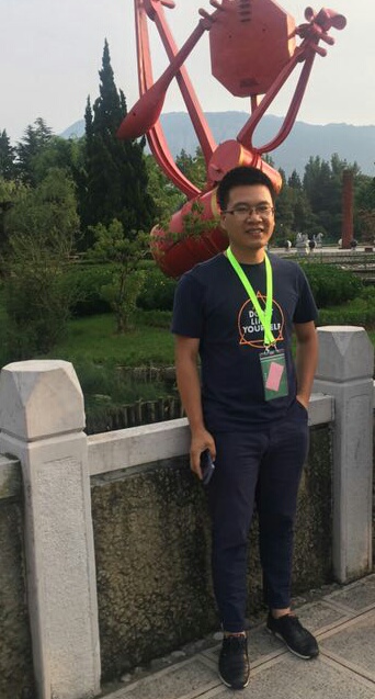
郑兴明 男 硕导 中国科学院东北地理与农业生态研究所
电子邮件: zhengxingming@iga.ac.cn
通信地址: 长春市高新北区盛北大街4888号
邮政编码:
电子邮件: zhengxingming@iga.ac.cn
通信地址: 长春市高新北区盛北大街4888号
邮政编码:
研究领域
研究方向
微波遥感基础理论;
高分辨率土壤水分多源遥感估算方法;
地面遥感场建设与遥感产品真实性检验;
农业水资源动态与作物水分利用效率。
招生信息
招生专业
070503-地图学与地理信息系统
招生方向
土壤遥感,植被遥感,农业遥感与水资源
教育背景
2007-09--2012-07 中国科学院东北地理与农业生态研究所 博士学位2003-09--2007-07 东北师范大学 学士学位
工作经历
工作简历
2018-01~现在, 中国科学院东北地理与农业生态研究所, 副研究员2016-01~现在, 中国科学院长春净月潭遥感实验站, 副站长2012-09~2017-12,中国科学院东北地理与农业生态研究所, 助理研究员
专利与奖励
奖励信息
(1) 先进工作者, , 研究所(学校), 2017(2) 吉林省优秀人才基金, 省级, 2016(3) 先进工作者, 研究所(学校), 2014
专利成果
( 1 ) 一种玉米植株叶倾角的提取处理方法, 发明, 2014, 第 1 作者, 专利号: 201110276519.9( 2 ) 低损耗介质介电常数测量装置及测量方法, 发明, 2013, 第 4 作者, 专利号: 201010555678.8
出版信息
发表论文
[1] Zheng, Xingming, Feng, Zhuangzhuang, Li, Lei, Li, Bingzhe, Jiang, Tao, Li, Xiaojie, Li, Xiaofeng, Chen, Si. Simultaneously estimating surface soil moisture and roughness of bare soils by combining optical and radar data. INTERNATIONAL JOURNAL OF APPLIED EARTH OBSERVATION AND GEOINFORMATION[J]. 2021, 100: http://dx.doi.org/10.1016/j.jag.2021.102345.[2] Zheng Xingming, Li Lei, Wang Chunmei, Han Leran, Jiang Tao, Li Xiaojie, Li Xiaofeng, Liu Fengrui, Li Bingze, Feng Zhuangzhuang. Measuring surface roughness of agricultural soils: Measurement error evaluation and random components separation. GEODERMA[J]. 2021, 404: http://dx.doi.org/10.1016/j.geoderma.2021.115393.[3] Zheng, Xingming, Feng, Zhuangzhuang, Xu, Hongxin, Sun, Yanlong, Bai, Yu, Li, Bingze, Li, Lei, Zhao, Xiaowei, Zhang, Rui, Jiang, Tao, Li, Xiaojie, Li, Xiaofeng. Performance of Four Passive Microwave Soil Moisture Products in Maize Cultivation Areas of Northeast China. IEEE JOURNAL OF SELECTED TOPICS IN APPLIED EARTH OBSERVATIONS AND REMOTE SENSING[J]. 2020, 13: 2451-2460, http://dx.doi.org/10.1109/JSTARS.2020.2995623.[4] Xingming Zheng, Zhuangzhuang Feng, Hongxin Xu, Yanlong Sun, Lei Li, Bingze Li, Tao Jiang, Xiaojie Li, Xiaofeng Li. A New Soil Moisture Retrieval Algorithm from the L-Band Passive Microwave Brightness Temperature Based on the Change Detection Principle. REMOTE SENSING[J]. 2020, 12(8): https://www.webofscience.com/wos/woscc/full-record/WOS:000534628800076.[5] Zheng, Xingming, Li, Lei, Chen, Si, Jiang, Tao, Li, Xiaofeng, Zhao, Kai. Temporal evolution characteristics and prediction methods of spatial correlation function shape of rough soil surfaces. SOIL & TILLAGE RESEARCH[J]. 2019, 195: http://dx.doi.org/10.1016/j.still.2019.104417.[6] Ding, Yanling, Zhang, Hongyan, Zhao, Kai, Zheng, Xingming. Investigating the accuracy of vegetation index-based models for estimating the fractional vegetation cover and the effects of varying soil backgrounds using in situ measurements and the PROSAIL model. INTERNATIONAL JOURNAL OF REMOTE SENSING[J]. 2017, 38(14): 4206-4223, https://www.webofscience.com/wos/woscc/full-record/WOS:000401460800012.[7] Jin, Mengjie, Zheng, Xingming, Jiang, Tao, Li, Xiaofeng, Li, Xiaojie, Zhao, Kai. Evaluation and Improvement of SMOS and SMAP Soil Moisture Products for Soils with High Organic Matter over a Forested Area in Northeast China. REMOTE SENSING[J]. 2017, 9(4): https://www.webofscience.com/wos/woscc/full-record/WOS:000402571700086.[8] Zheng Xingming, Jiang Tao, Li Xiaofeng, Ding Yanling, Zhao Kai. The temporal variation of farmland soil surface roughness with various initial surface states under natural rainfall conditions. SOIL & TILLAGE RESEARCH[J]. 2017, 170: 147-156, http://dx.doi.org/10.1016/j.still.2017.03.015.[9] Zheng, Xingming, Li, Xiaofeng, Jin, Mengjie, Jiang, Tao, Zhao, Kai. Characteristics of L-band transmissivity and effective scattering albedo of boreal forests: a case study in northeast China. REMOTE SENSING LETTERS[J]. 2017, 8(12): 1200-1209, https://www.webofscience.com/wos/woscc/full-record/WOS:000418563800011.[10] Zheng, Xingming, Li, Xiaofeng, Jiang, Tao, Ding, Yanling, Wu, Lili, Zhang, Shiyi, Zhao, Kai. Retrieving soil surface temperature under snowpack using special sensor microwave/imager brightness temperature in forested areas of Heilongjiang, China: an improved method. JOURNAL OF APPLIED REMOTE SENSING[J]. 2016, 10: http://159.226.123.10/handle/131322/7082.[11] Zheng, Xingming, Zhao, Kai, Ding, Yanling, Jiang, Tao, Zhang, Shiyi, Jin, Mengjie. The spatiotemporal patterns of surface soil moisture in Northeast China based on remote sensing products. JOURNAL OF WATER AND CLIMATE CHANGE[J]. 2016, 7(4): 708-720, https://www.webofscience.com/wos/woscc/full-record/WOS:000390433900004.[12] Ding, Yanling, Zheng, Xingming, Zhao, Kai, Xin, Xiaoping, Liu, Huanjun. Quantifying the Impact of NDVIsoil Determination Methods and NDVIsoil Variability on the Estimation of Fractional Vegetation Cover in Northeast China. REMOTE SENSING[J]. 2016, 8(1): http://159.226.123.10/handle/131322/7072.[13] Li Xiaofeng, Zheng Xingming, Wu Lili, Zhao Kai, Jiang Tao, Gu Lingjia. Effects of snow cover on ground thermal regime: A case study in Heilongjiang Province of China. CHINESE GEOGRAPHICAL SCIENCE[J]. 2016, 26(4): 527-538, http://159.226.123.10/handle/131322/6865.[14] Che, Tao, Dai, Liyun, Zheng, Xingming, Li, Xiaofeng, Zhao, Kai. Estimation of snow depth from passive microwave brightness temperature data in forest regions of northeast China. REMOTE SENSING OF ENVIRONMENT[J]. 2016, 183: 334-349, http://dx.doi.org/10.1016/j.rse.2016.06.005.[15] Yanling Ding, Xingming Zheng, Tao Jiang, Kai Zhao. Comparison and Validation of Long Time Serial Global GEOV1 and Regional Australian MODIS Fractional Vegetation Cover Products Over the Australian Continent. REMOTE SENSING[J]. 2015, 7(5): 5718-5733, http://159.226.123.10/handle/131322/6436.[16] 郑兴明. 基于Landsat 8 OLI数据的玉米冠层含水量反演研究. 光谱学与光谱分析. 2014, [17] Li, Xiaofeng, Zhao, Kai, Wu, Lili, Zheng, Xingming, Jiang, Tao. Spatiotemporal analysis of snow depth inversion based on the FengYun-3B MicroWave Radiation Imager: a case study in Heilongjiang Province, China. JOURNAL OF APPLIED REMOTE SENSING[J]. 2014, 8: https://www.webofscience.com/wos/woscc/full-record/WOS:000337097600002.[18] Ding, Yanling, Zhao, Kai, Zheng, Xingming, Jiang, Tao. Temporal dynamics of spatial heterogeneity over cropland quantified by time-series NDVI, near infrared and red reflectance of Landsat 8 OLI imagery. INTERNATIONAL JOURNAL OF APPLIED EARTH OBSERVATION AND GEOINFORMATION[J]. 2014, 30: 139-145, http://dx.doi.org/10.1016/j.jag.2014.01.009.[19] Zheng Xingming, Zhao Kai, Li Xiaojie, Li Yangyang, Ren Jianhuaa. Improvements in farmland surface roughness measurement by employing a new laser scanner. SOIL & TILLAGE RESEARCH[J]. 2014, 143: 137-144, http://dx.doi.org/10.1016/j.still.2014.06.010.[20] Ding, Yanling, Ge, Yong, Hu, Maogui, Wang, Jinfeng, Wang, Jianghao, Zheng, Xingming, Zhao, Kai. Comparison of spatial sampling strategies for ground sampling and validation of MODIS LAI products. INTERNATIONAL JOURNAL OF REMOTE SENSING[J]. 2014, 35(20): 7230-7244, http://dx.doi.org/10.1080/01431161.2014.967889.[21] Li, Yangyang, Zhao, Kai, Zheng, Xingming, Ren, Jianhua, Ding, Yanling, Wu, Lili. Identification of saline-alkali soil based on target decomposition of full-polarization radar data. JOURNAL OF APPLIED REMOTE SENSING[J]. 2014, 8: https://www.webofscience.com/wos/woscc/full-record/WOS:000348669400003.[22] Gu Lingjia, Zhao Kai, Zhang Shuang, Zheng Xingming. An AMSR-E data unmixing method for monitoring flood and waterlogging disaster. CHINESE GEOGRAPHICAL SCIENCE[J]. 2011, 21(6): 666-675, http://lib.cqvip.com/Qikan/Article/Detail?id=39811302.[23] Zheng Xingming, Zhao Kai. A Method for Surface Roughness Parameter Estimation in Passive Microwave Remote Sensing. CHINESE GEOGRAPHICAL SCIENCE[J]. 2010, 20(4): 345-352, http://lib.cqvip.com/Qikan/Article/Detail?id=34341181.
科研活动
科研项目
( 1 ) 遥感产品真实性检验关键技术及其试验验证专题“遥感产品全国真实性检验网点试运行”, 主持, 国家级, 2012-01--2014-11( 2 ) 被动微波遥感土壤水分反演精度与空间异质特征的相关性研究, 主持, 国家级, 2014-01--2016-11( 3 ) 联合主被动微波数据的中分辨率农田土壤水分反演算法, 主持, 省级, 2017-01--2018-12( 4 ) 东北典型地物波谱数据采集, 主持, 国家级, 2014-05--2019-05( 5 ) 微波遥感土壤水分产品真实性检验与算法研究, 主持, 研究所(学校), 2017-01--2018-12( 6 ) 基于微波遥感的土壤水分监测方法, 主持, 研究所(学校), 2017-01--2018-12( 7 ) 净月潭真实性检验站场地建设与验证数据获取, 主持, 研究所(学校), 2018-01--2020-12( 8 ) 土壤水分与表面粗糙度的光学与雷达遥感协同反演算法研究, 主持, 国家级, 2020-01--2023-11( 9 ) 十三五空基真实性检验站(净月潭站)建设, 主持, 研究所(学校), 2020-12--2024-11
